News and Media Releases
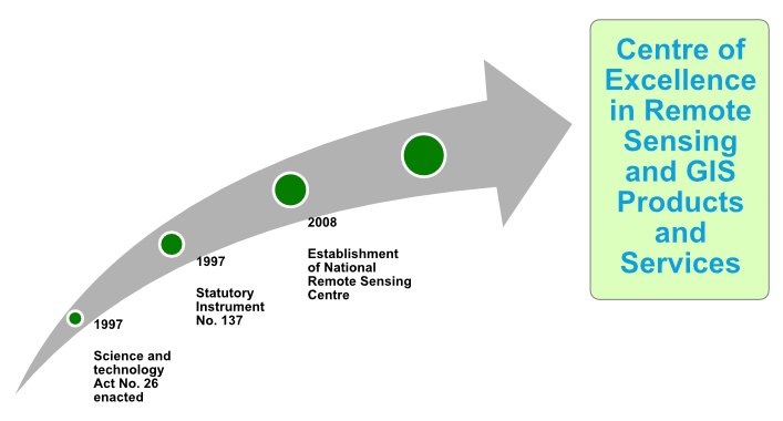
The National Remote Sensing Centre (NRSC) was established through the issuance of Statutory Instrument No. 137 of 1999 of the Science and Technology Act (No. 26 of 1997). The idea of setting up the NRSC was mooted at an international conference hosted by the then Ministry of Science, Technology and Vocational Training (MSTVT) in 1997.
OUR MANDATE
To promote and conduct remote sensing activities for industrial advancement in Zambia.
OUR VISION
To be a Centre of Excellence in remote sensing and GIS products and services
OUR MISSION
To provide timely remote sensing data and other geo-information products and services to contribute to decision making at local, national and regional level.
Based on its mandate, vision and core values, the NRSC aspires to be a center of excellence in remote sensing and GIS product and services.


